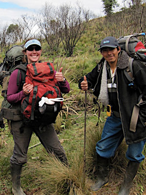
Scientific Research Collaborations
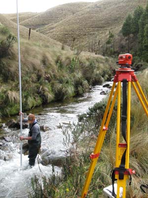
 Geomorphic assessment of the Ningar River
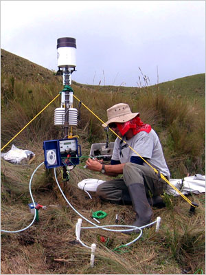
The Ningar River, which drains a large portion of the Mazar Wildlife Reserve, is an example of a relatively un-impacted Andean headwater river system. And like other Andean headwater streams draining the páramo, the Ningar River is likely to experience future impacts associated with land use change, climate change, and hydro-development. Between 2015 and 2017 Professor Derek Martin, and his graduate students of Appalachian State University performed a suite of field assessments to better understand the hydro-geomorphic characteristics of the Ningar River, which will help to provide a baseline for future monitoring of impacts to Andean headwater streams draining these unique and critically important ecosystems.
The objectives of this study were to (1) Perform hydro-geomorphic assessments to allow a quantitative comparison of the Ningar River to other mountain river systems, (2) Determine “natural” bank erosion rates along the páramo section of the Ningar River, and (3) Evaluate the implications of objectives 1 and 2 within the context of management/protection of páramo ecosystems, hydro-development in the Andes, and carbon accounting in the páramo.
Results indicate that the Ningar River displays similar form-function characteristics as other mountain headwater streams (globally) but displays more of an alluvial character than might be expected for montane headwater systems as a result of a convexity in the stream’s longitudinal, topographic profile; a feature that appears common among many Andean headwater streams as a result of the regional geology. Preliminary analyses suggest that natural bank erosion contributes substantially to river system sediment loads, highlighting the importance of páramo headwater streams’ role in providing certain sediment/nutrient inputs to downstream ecosystems. Also, given the organic carbon content of valley-bottom páramo soils, bank erosion could be an important - but unaccounted for - component of terrestrial-to-fluvial carbon flux pathways. Analyses of these data are ongoing.
Available Reports:
Martin DJ, C Ely, & BC Wemple. (2019). Bank erosion in an Andean páramo river system: Implications for hydro-development and carbon dynamics in the neotropical Andes. Journal of Mountain Science 16(2):243-255.
Ely C, & DJ Martin. (2018). Investigating the Geomorphic characteristics of an Amazonian headwater stream draining a Páramo ecosystem. Physical Geography 40(2):164-185
Assessing the effects of afforestation in páramo ecosystems on soil carbon processes
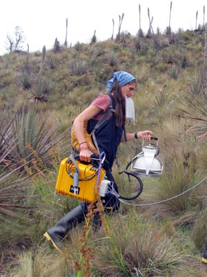
In what ways does altered soil hydrology under pine plantations established in páramo ecosystems affect terrestrial carbon losses through soil carbon dioxide respiration and aquatic carbon export in páramo catchments? Professor Carol Harden and Ph.D. candidate Julie McKnight, from the University of Tennessee, Knoxville, are investigating these questions on the Mazar Wildlife Reserve.
This comparative study will examine soil carbon processes in two distinct types of land cover: (i) páramo with native vegetation and no burning for 30 years, and (ii) páramo covered with a 25-year old pine (Pinus patula) plantation.
In December 2013, Carol Harden and Julie McKnight visited the Mazar Wildlife Reserve to measure carbon dioxide flux and aqueous carbon export. They also measured environmental factors known to influence soil carbon processes to better understand biogeochemical processes driving gaseous and aquatic exports. These environmental factors include soil temperature, moisture, carbon content, and labile soil carbon pools.
This research aims to contribute toward our understanding of the differences between local terrestrial carbon budgets in páramo ecosystems under different land uses.
Available Reports:
McKnight JY. (2015). Linking soil moisture and carbon-cycle processes in two understudied terrestrial ecosystems: Ecuadorian páramo grasslands and constructed agricultural wetlands (Doctoral thesis). University of Tennessee, Knoxville.
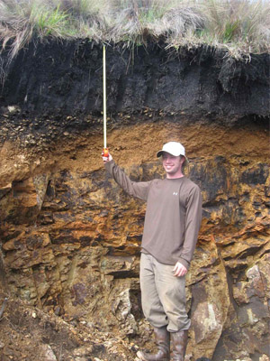
Carbon sinks found in páramo grassland soils
The science linking land use/cover to ecosystem services lags behind program implementation, leading to uncertainty whether promoted land uses/covers actually protect or enhance targeted services. While worldwide the majority of carbon-based payment for environmental services projects have focused on afforestation, reforestation, and more recently on avoided deforestation, there is increasing recognition of the need to protect and sustainably manage biodiverse non-forested ecosystems that store large amounts of carbon belowground as soil organic matter. Páramo grasslands are an example of such a system; these ecosystems support impressive levels of endemic plant and animal diversity as well as storing a high amount of soil carbon. Thus, páramos represent important carbon sinks and area in need of conservation.
Since mid-2009, Leah Bremer, candidate for a Ph.D. in Geography at San Diego State University and the University of Santa Barbara, California, USA, has studied soil carbon in different native and non-native montane ecosystems at sites across Ecuador. At the Mazar Wildlife Reserve, she is studying above-ground plant diversity in páramo grasslands in addition to soil carbon. Her preliminary results make a strong case for the increased protection and sustainable management of páramo grasslands given their exceptional capacity for carbon storage and high levels of endemic plant diversity.
Available Reports:
Bremer LL, KA Farley, D Lopez-Carr, & J Romero. (2014). Conservation and livelihood outcomes of payment for ecosystem services in the Ecuadorian Andes: What is the potential for 'win–win'? Ecosystem Services 8:148-165.
Bremer LL, KA Farley, & D Lopez-Carr. (2014). What factors influence participation in payment for ecosystemservices programs? An evaluation of Ecuador's SocioPáramo program. Land Use Policy 36:122-133.
Bremer L, KA Farley, C Harden, J Hartsig, & J Lee. (2013). Biodiversidad, almacenamiento de carbono, e hidrología de los suelos bajo distintos usos de suelo de los páramos de la Reserva de Vida Silvestre Mazar, Parque Nacional Sangay, Cañar, Ecuador. Universidad Estatal de San Diego, California y Universidad de Tenesse, Knoxville.
Bremer LL. (2012). Land-use change, ecosystem services, and local livelihoods: ecological and socioeconomic outcomes of Payment for Ecosystem Services in Ecuadorian páramo grasslands (Doctoral Thesis). San Diego State University and University of California, Santa Barbara, California.
Farley KA, LL Bremer, CP Harden, & J Hartsig. (2013). Changes in carbon storage under alternative land uses in biodiverse Andean grasslands: implications for payment for ecosystem services. Conservation Letters 6:21–27. doi: 10.1111/j.1755-263X.2012.00267.x
Harden C, K Farley, L Bremer, & J Hartsig. (2015). Informe: Servicios ambientales ecosistémicos y cambio en el uso de suelo en el páramo. Universidad de Tennessee, Knoxville, Tennessee; Universidad Estatal de San Diego, San Diego, California; Universidad de California, Santa Barbara.
Land use and the hydrological properties of páramo soils
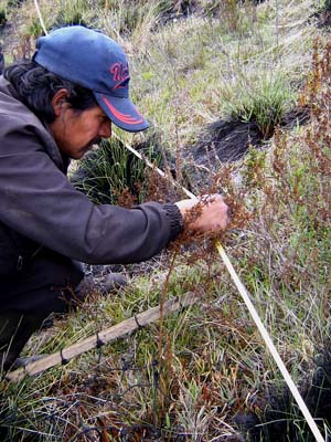
In what ways do changes in above-ground vegetation affect the ability of páramo soils to regulate water storage and flow? For example, if trees are planted or fire regimes altered, how does a soil's hydrologic function respond? Professor Carol Harden and graduate students James Hartsig and Hunter Terrell, from the University of Tennessee, Knoxville, are investigating these questions in the Mazar Wildlife Reserve.
In 2009, the team selected study sites across the Mazar Wildlife Reserve with different land-uses. At these sites, they installed rain gauges and sensors that monitor soil moisture changes in real time. They have also measured soil moisture on a fine spatial and temporal scale, sampled soils at different depths to test their water retention capacity, and traced the rate of subsurface water movement through two experimental plots, one in non-native pine trees and another in native páramo grasses.
Preliminary results show that soils under pine stands are drier and have more variable moisture contents than soils under native páramo grasses, and also that they have a lesser capacity to store water. Although further analysis remains to be done, these initial results suggest that soil-water relationships in páramo soils differ between native and non-native vegetative cover.
Available Reports:
Harden CP, J Hartsig, KA Farley, J Lee, & LL Bremer. (2013). Effects of land-use change on water in Andean páramo grassland soils. Annals of the Association of American Geographers, 103(2):375-384.
Hartsig J. (2011). The Effects of Land-Use Change on the Hydrological Properties of Andisols in the Ecuadorian Páramo (Master's thesis). The University of Tennessee, Knoxville, Tennessee.
Land-use and land cover change between 1956 and 2000
The Nudo del Azuay is an area in transition, with pastures and agricultural areas replacing native tropical montane forest and páramo grasslands. The long-term conservation of this landscape necessitates a clear understanding of threats to the landscape as well as restoration on the part of local land stewards.
FCT began a study of land-use and land cover change in January 2010 with the eventual goal to analyze the rate, extent, and intensity of land use and land cover changes over the past fifty years. We are using aerial photos of the Nudo del Azuay taken during flyovers from 1956 to 2000. Geographer Will Anderson geographically referenced and topographically corrected the photos to create blocks of digital orthophotos, and a FCT technician is manually identifying land cover within each of the photos.
This study of aerial photos allows FCT to analyze changes over a longer time period than satellite images (which are only available beginning in the 1980s), as well as facilitating a more precise identification of land cover types. The results of this analysis will be used to model current and future land cover change scenarios, identify place-specific drivers of degradation as well as recuperation, and relate Andean bear habitat use to information about forest age and composition.
Available Reports:
Anderson W. (2010). Technical Report: Analysis of Historical Land Cover of the Nudo del Azuay using Aerial Photos (Stage 1 of 2, Orthophoto Generation). Cuenca, Ecuador: Fundación Cordillera Tropical.